A Five-year Wait for the Train
The Cuesta is the most difficult climb on the entire Coast Line between San Francisco and Los Angeles. Santa Margarita, at milepost 236 and elevation 998 feet, and San Luis Obispo, at milepost 252 and elevation 240 feet, are about 10 miles apart by highway but 16 rail miles from each other. (On the Coast Line mile markers begin at San Francisco. So does numbering of tunnels, noted below. Mileposts have changed over the years due to alignment changes.)
Cuesta is steep in both directions. The steepest portion of the grade is about 2.2%, or a little more than two feet elevation gained for each 100 feet traveled. There are places on the Cuesta where the track turns back on itself in such a way that both ends of a passenger train can easily be seen from the middle. These characteristics limit the maximum speed to 30 mph for passenger trains and 25 mph for freight trains.
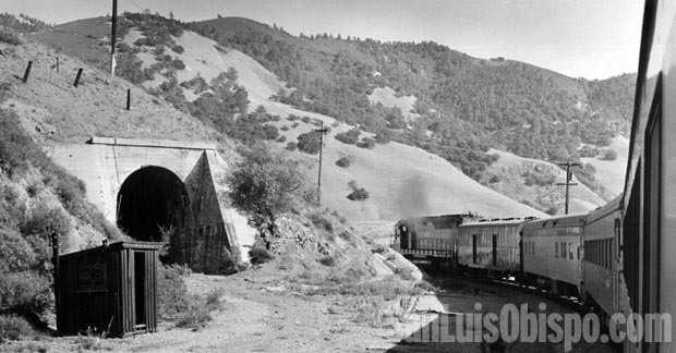
The railroad passes through five tunnels, the most difficult part of the railroad’s construction. All were built to similar dimensions, about 16 feet wide and 18 feet maximum height. They were hand drilled, and most were lined with heavy redwood timbers. About 1.1 million cubic yards of rock were removed from the seven tunnels, a world record for hand-drilled tunneling.
Tunnel 6, the summit tunnel, is 3,600 feet long and contains the high point of the grade (1,380 feet elevation). It is followed closely by tunnels 7 (1,354 ft. long), 8 (481 ft. long) and 9 (527 feet long). At a sharp turn to the right, trains pass what used to be Tunnel 10. Just after midnight on February 24, 1910 -without warning- 46 feet of the tunnel caved in. The railroad determined that the tunnel was no longer safe, so it was bypassed.
Between 1940 and 1959, nearly the entire length of tunnels was enlarged and relined with concrete. It took 14 years because the railroad decided to continue regular train schedules without interruption on the single track. This meant crews could only work between trains. The geology of the Santa Lucia range also complicated the job, the rock being heavily faulted. It has areas of serpentine (greenish rock, California’s state mineral), shale (black and layered), and volcanic rocks. There are also subterranean springs of acidic water. The procedure for the enlargement was to remove one segment of the original lining at a time, excavate the enlargement, and then install new lining in that segment before removing the next part. Additional concrete lining was installed in the summit tunnel following a 1987 fire involving the original timber lining.
About a mile beyond the former Tunnel 10 is Serrano siding, named for Miguel Serrano from whom the Southern Pacific obtained the right-of-way in 1893. One mile farther is “Little Horseshoe Curve.”
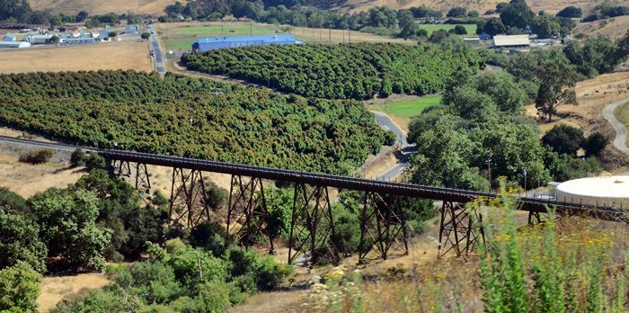
Immediately after passing through Tunnel 11 (722 feet long), the line reaches Chorro, where there are great views over San Luis Obispo and the Stenner Creek trestle. Chorro is Spanish for rapids and refers to the creek and the two adjacent land grants-Arroyo del Chorro and Cañada del Chorro.
The more widely known Horseshoe Curve is shortly before Stenner Creek trestle.
Just before the bridge is Goldtree and the remains of a turning “wye.” From the 1930s through the 1950s this wye led to a branch that reached Camp San Luis, a major training base during World War II.
Stenner Creek trestle, a steel structure built in 1904 and reinforced in the 1920s, is 80 feet tall and 931 feet long, making it the longest bridge on the Coast Line (Gaviota is 811 feet long). Bridge components were fabricated in Pittsburgh and brought west on over 50 freight cars. The bridge was the last major part of construction over Cuesta.
Hathaway, just north of the present Highway 101, was the last siding before reaching the San Luis Obispo depot. At one time it served two sugar-beet loading facilities and a storage and distribution site for Standard Oil. Hathaway was named for Dr. Hathaway, over whose estate the railroad was constructed into San Luis Obispo in 1894.


